
Sources for Cicero Neighbors
Public sources describe a block in layers. CookViewer defines parcel adjacency. The Assessor describes each PIN, which is the county's parcel identification number. Clerk Recordings links parcels to recorded documents. Historical books and maps show an older block. Illinois voter data cannot be turned into an unrestricted resident roster, and Cicero has no verified public directory of neighborhood-association members.
| Source | What It Shows About a Block | Access |
|---|---|---|
| CookViewer | Parcel outlines, nearby parcel candidates, streets, intersections, map reports | Free online viewer |
| Cook County Assessor | PIN, values, traits, exemptions, tax code for each parcel | Free PIN pages |
| Clerk Recordings System | Deeds, easements, plats, legal descriptions, document parties | Online index; some items downtown |
| Library history sources | Dated directories, phone books, news, census, yearbooks | Appointment, card databases, or images |
| Town sources | Permits, planning context, watch notices, public facilities | Department, FOIA, or publication |
An assessed taxpayer, deed grantee, mailing recipient, and occupant are not the same role. A public parcel page may describe the building without naming who lives there. Even when a recorded document names a person, it proves that person's role in that instrument, not present occupancy. Those distinctions keep a search for Cicero neighbors accurate.
Define Nearby in Cicero Records
Choose the unit before searching. Parcel-adjacent means lots that touch or sit directly across a mapped edge. A block face means addresses along one side between intersections. A historical directory street section is a dated printed sequence. A named Cicero neighborhood is broad civic and historical context. Mixing these units can create a false group.
- Parcel
- A mapped unit of land tied to a PIN and legal description.
- Block face
- One side of a street between two cross streets.
- Plat
- A recorded map of lots, streets, alleys, and other features.
- Easement
- A recorded right to use part of land for a stated purpose.
Corner lots, alleys, irregular boundaries, and multiunit buildings make house-number subtraction unreliable. Use geometry for the immediate block, then preserve the map date and scale.
Map Cicero Neighbors by Parcel
CookViewer accepts an address, PIN, or intersection. Its Nearby Search requires a selected source parcel first. The fetched help did not expose exact radius choices, so do not assume a distance setting. Work from visible parcel lines and save the source PIN and retrieval date.
- Normalize the Cicero address and find it in CookViewer. Confirm the street and parcel outline before selecting it.
- Select the source parcel, then open Nearby Search. Record the adjacent PINs instead of guessing from postal numbers.
- Open each PIN separately in the Assessor record. Compare property traits and dates without treating a mailing address as occupancy.
- Use Compare Properties or a printed map report when several lots must be aligned. Keep alleys and corner geometry visible.
- Search a specific PIN in Clerk Recordings only when deeds, plats, shared access, or easements matter.
For every address along the full road, switch to the Cicero street directory workflow. The neighbor method stays focused on the immediate cluster.
Cicero Parcel Records Need Context
The Assessor's public address search asks for a house number, street name without the suffix, city, and CAPTCHA. It also has a neighborhood mode using Cicero Township, a dynamic neighborhood field, and optional property class. The public interface showed no universal owner-name field. A parcel result can contain building traits, value history, exemption history, and a tax code.
The Assessor warns that “Property Location” is used to locate the parcel and is not a legal or postal mailing address. That warning is vital for neighbor research. A separate mailing field can point somewhere else, and neither field alone proves who sleeps at the site. Use a deed image and legal description for recorded title questions. Use dated directories or census records for historical occupants.
Cicero Neighborhood Names as Clues
The Town's official history names Grant Works, Hawthorne, Warren Park, Drezel, Clyde, Morton Park, Boulevard Manor, and Parkholme. These eight labels make useful search terms in old papers, photographs, directories, and planning files. They are not a legal parcel map. Cicero's Comprehensive Plan discusses neighborhood branding and older names as planning context, not exact membership or association boundaries.
Rail and industry shaped some of those places. Burlington, Illinois Central, Belt Line, Hawthorne Works, and Grant Works can improve a historical search. Keep the publication year attached because Cicero's boundaries changed from 1857 through 1901. An old use of “Cicero” may refer to a wider place than the town today.
Cicero Community Contacts, Not Rosters
No official, exhaustive current directory of independent Cicero neighborhood associations, boundaries, contacts, or members was found. The verified items below supply civic context. They cannot establish where a member lives or who belongs to a block.
| Cicero Neighborhood Watch | June 2022 Town News documented a town-wide meeting and Cicero Outreach contact trail; no public member roster. |
|---|---|
| Town neighborhood names | Eight historical place names from the Town About page and Comprehensive Plan; not association boundaries. |
| Town departments | Public offices, parks, library, senior and community centers can anchor civic map research. |
| Arts and community groups | The plan discusses them as place-making context, not a verified current directory. |
A group notice proves that an event or organization was publicized. It does not prove that named Cicero neighbors attended, joined, or lived near the meeting place.
Rebuild Historical Cicero Neighbors
The Cicero Public Library house-history route combines assessor data, recordings, permits, census schedules, architecture, directories, and news. A historical block should be labeled by year. The library's city directories cover 1913 and parts of 1920 through 1945; telephone books cover parts of 1973 through 2018. Missing editions bar a seamless roster.
The library page shown below gives the local research sequence and appointment route.
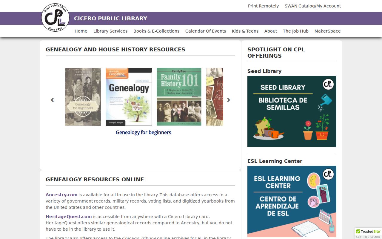
The workflow helps separate a named directory occupant from a deed owner and a building shown on a Sanborn map.
Sanborn maps and plats show physical form, not people. Census pages, directories, and newspapers add names, but each needs a year, page, and source. Mark businesses, institutions, owners, and occupants as different roles.
Cicero Neighbor Sources Compared
Official records and commercial neighbor tools do different work. The official route takes more steps, but it preserves the agency, date, and meaning of each field. Commercial listings can merge stale data and unclear sources. They should not replace the parcel map or custodian copy.
| Question | Official Source | Commercial Category |
|---|---|---|
| Which lots are adjacent? | CookViewer parcel geometry | May use an unexplained radius |
| What does a parcel record show? | Assessor PIN page with tax year | May blend old fields |
| What document affects the lot? | Clerk index and document copy | May omit legal detail |
| Who appeared there before? | Dated library and archive sources | Source date may be unclear |
Cicero Block Records Offline
Online maps do not cover every block question. Clerk Maps, at 118 N. Clark Street, Room 434 in Chicago, handles map-related inquiries at 312-603-5640 and clerk.maps@cookcountyil.gov. Clerk Recordings is in Room 120 at the same address and can route recorded-document questions. Some plats, easements, and related document categories may require downtown retrieval even when the index identifies them. Bring the PIN, document number, legal description, and a narrow question. An address alone may point to the wrong lot.
Town records form another channel. The Cicero Building Department may hold permits, plans, inspections, and property-maintenance files. The Town Assessor's field books, transfer sheets, master sheets, and duplicate field cards can bridge a gap in county pages. No general public portal for those municipal files was located. Ask the office for access or submit a record-based Illinois FOIA request with specific addresses and dates. Agencies may redact private details or withhold exempt material.
Historical neighbor research has its own fallback chain. Make an appointment with the Cicero Public Library Local History Room, ask for the exact directory or telephone-book year, and note missing editions before traveling. IRAD-NEIU accepts in-person, telephone, and mail research requests for Cook County series, but its policy does not accept email research requests. State and library databases may require a card, account, or on-site terminal. These channels matter because a failed web search does not prove that a map, permit, directory volume, or recorded instrument does not exist.
Privacy Limits for Cicero Neighbors
Illinois voter law restricts bulk-list use and redacts street numbers, birth dates, phone numbers, email addresses, and sensitive fields. The state lookup is an identity and address verification process, not a name-browse tool for a block. The Address Confidentiality Program can provide a substitute address for qualifying survivors in new records, though it does not erase older public records. Court sealing and agency redaction follow their own processes.
Utility use, delivery data, private contact details, and complete household membership are not public neighbor-directory fields. Public parcel records can also contain old or limited data. Keep only the source type, agency, URL, retrieval date, search category, and public result needed for lawful research. Avoid storing full birth dates, private phone or email data, and the current address of a person at risk.
Lawful use. Research Cicero neighbors for civic knowledge, history, reconnection, or safety. Never use records to watch, threaten, harass, or harm a person.